Mousseau Range, PQ 
Select a photograph to view a photo gallery
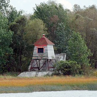
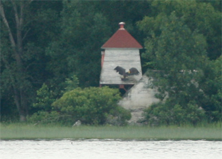

Photo Gallery


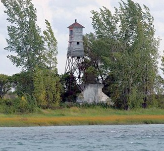


Photo Gallery
Photo Gallery
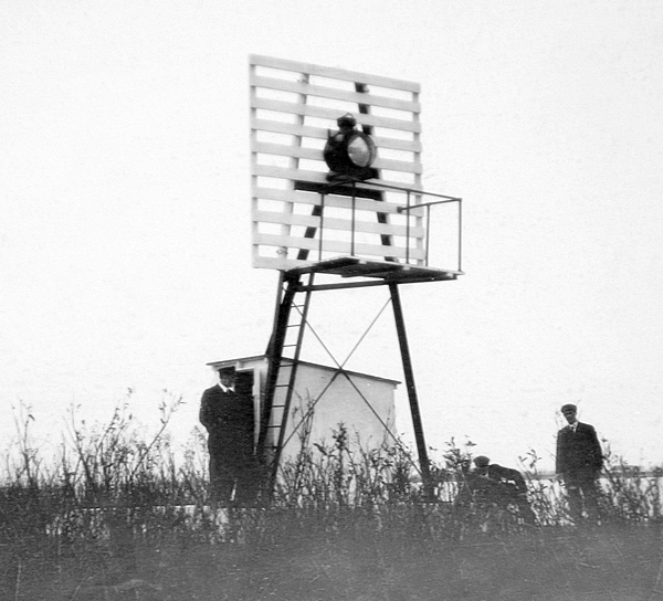
In 1913, range lights were erected on the northeast shore of Île Bouchard at a cost of $1,858.56, and just before the range was activated at the opening of navigation in 1914, the following description of the lights was published in a Notice to Mariners:
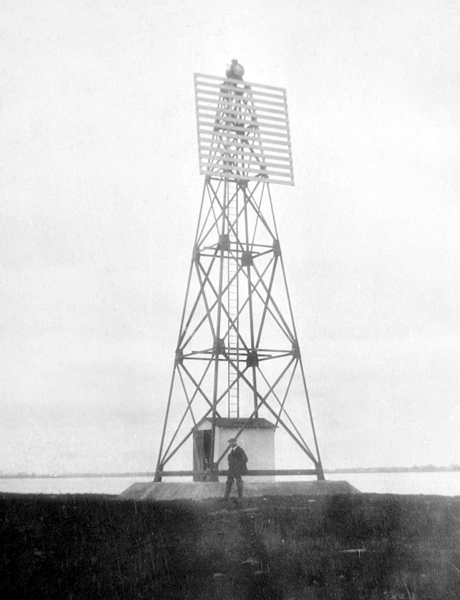
Mousseau Range
Front Light. A fixed white catoptric light of 900 candlepower, visible 6 miles in the line of range, exhibited 18 feet above the summer level of the river from a triangular skeleton steel tower 19 feet high, with square slatwork on the upper portion of the side facing the alignment and a shed at the base, tower red, slats and shed white, erected on a square concrete pier 2 feet high, on the northern side of Ile Bouchard 140 feet back from low-water mark.Rear light. A Fixed white catoptric light of 900 candlepower, visible 6 miles in the line of range, exhibited 57 feet above the summer level of the river from a skeleton tower 49 feet high, square in plan, with sloping sides, with square slatwork on the upper portion of the side facing the alignment and a shed at the base, tower red, slats and shed white, with red roof, erected on a square concrete pier 2 feet high, on the northern side of Ile Bouchard, 200 feet back from low-water mark and 2,022 feet 219° 45 from the front light.
The range lights served to guide vessels between Contrecoeur Traverse Range, located just downstream, and Bouchard Peninsula Range, located just upstream on Île Ronde. Mousseau Range, Bouchard Peninsula Range, St. Sulpice Traverse Range, St. Sulpice Course Range, and Ile Lebel Range were all activated in 1914 to guide mariners along the Repentigny Channel that ran on the north side of the river between Lavaltrie and Repentigny. A different series of range lights served to guide mariners along the channel south of the string of islands located between Saint-Sulpice and Verchères.
At some point after 1959, the range towers were either modified or replaced with new ones that have enclosed lantern rooms. Mousseau Range Lights were deactivated in 1996.
Keepers: J.B. Giguère (1914 at least 1937).
References